The Thermal Dome in the Eastern Tropical Pacific Ocean and the Sargasso Sea in the North Atlantic Ocean are two unique initiatives to serve as pilot cases to advance conservation in the high seas and to test and promote the concept of hybrid governance, i.e. modes of governance that combine a regional approach and a global approach on the high seas.
With SARGADOM we want to :
It is based on a socio-ecosystem diagnostic analysis in each site, and an analysis of the current governance of the two sites and potential improvements, which will lead to the development of proposals to improve the governance and to establish conservation and management measures in these sites

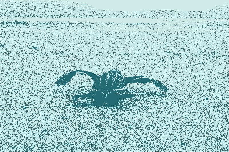
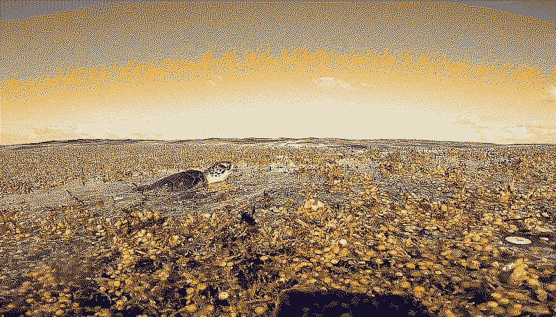
The Thermal Dome is located within and beyond the Exclusive Economic Zones (EEZs) of Central American countries in the Eastern Tropical Pacific. It is a phenomenon formed by the convergence of trade winds and sea currents that cause deep, cold and nutrient-rich waters to rise (upwelling). The thermocline is thus “lifted” up to about 15 meters from the surface, giving, through its bell shape, its name of “dome”. The size and location of the Thermal Dome is dynamic. Its average surface area is 530,000 km2. Its central zone is located around 9°N and 90°W, more than 65 km west of the borders of the EEZs of Costa Rica and Nicaragua, i.e. beyond their respective national jurisdictions.
Since 2010, the Sargasso Sea Project, developed in association with IUCN and other partners and led by the Government of Bermuda, has been working with a wide range of stakeholders from government, academia and the private sector, as well as interested collaborators, to bring the importance of the Sargasso Sea ecosystem to the attention of the international community. It seeks to use existing competent international organizations to implement conservation measures for the Sargasso Sea, and to use this process as a model for other regions. In 2014, governments met in Bermuda to sign the Hamilton Declaration on Collaboration for the Conservation of the Sargasso Sea, which as of 2023 has a total of ten government signatories (The Azores, Bahamas, Bermuda, British Virgin Islands, Canada, Cayman Islands, Dominican Republic, Monaco, the United Kingdom and the United States). It is a non-binding political agreement between interested governments located in the wider Sargasso Sea region or with an interest in the conservation of the high seas. The Sargasso Sea Commission, an independent body established by a political declaration, has been described as a new paradigm for governance on the high seas.
The Sargasso Sea is bordered by the flow of major ocean currents – the Gulf Stream forms its Western limit and the North Atlantic Current forms its northern limit, the Canary Current acts as a more diffuse eastern limit, and the Northern Equatorial Current together with the Caribbean Current, form the southern limit. Only the small islands of Bermuda have a direct coastline on the Sargasso Sea.
2007-2026 – New England Seamounts Vulnerable Marine Ecosystem (VME)
SEDA aims to identify the importance of the ecosystem in question, the value of its goods and services, who benefits from these goods and services, what the threats and real/potential impacts are to the ecosystem and its goods and services and how these threats might be mitigated or eradicated.
A common strategy is built inspired by the TDA-SAP approach developed by GEF and other DPSIR applications for marine management.
The SEDA will provide a baseline to guide the long-term collaborative monitoring of the natural resources and their conservation by the relevant instruments, framework and bodies (IFBs).
Articulation of knowledge to develop an argument related to conservation issues
Put forward the argument towards those with action competency
In practice, in any context and particularly in the high seas, the main technical role of a SEDA is to identify, quantify, and set priorities for environmental problems that threaten the long-term integrity and sustainability of the ecosystem. In particular, the SEDA aims to:
A SEDA will be done for the Thermal Dome and another one for the Sargasso Sea
Following the SEDA, which involves in-depth and regular consultations with the relevant authorities and governments concerned, as well as academia, NGOs, the private sector and other stakeholders, a sectoral and multi-sectoral consultation modalities will be set up to establish management rules. This stakeholder association will prefigure the modalities of appropriate governance for each of the two sites, which will be the subject of proposals at the end of the project.
Discussions and consultations will involve experts and institutions, including the private sector, management organizations and, where appropriate, coastal communities. The two sites work closely together, taking into account and benefiting from the different policy environments of each.
The SEDA is based on a reasoned and multi-sectoral consideration of the problems and it is a factual basis for the formulation of the Strategic Action Programme (SAP). The SAP sets out the actions that are required by all the partners who will adopt the SAP in order to address the impacts and threats highlighted in the SEDA. It outlines what the policy, legal, and institutional improvements and investments are needed to resolve the priority ecosystem problems identified through the SEDA. This is a negotiated document because it has political, legal and administrative implications.
For this, strategies are different between the two sites, with more direct negotiations at the Sargasso Sea Commission level and the setting up of working groups and a regional work plan led by MarViva at the Central American Commission for Environment and Development (CCAD) level.
Before the project
During the project
At the Central American level, MarViva and its local partners are working with Central American national governments to integrate the initiative around the Thermal Dome into the CCAD regional maritime agenda.
Ten governments are already signatories to the Hamilton Declaration to work with the Sargasso Sea Commission.
Before the project
*Vulnerable Marine Ecosytem
*Vulnerable Marine Ecosytem
*Ecologically or Biologically Significant Marine Area
During the project
Lessons learned will be distributed through various capacity building activities, including the development of a multilingual Massive Open Online Course (MOOC) on governance and conservation on the high seas.
SARGADOM is a research projet that aims to contribute to a hybrid governance to protect and manage two remarkable areas of the high seas
© SARGADOM 2024 All Rights Reserved | Legal Notice